
Table of Contents:
Start in Split: Check-In, Diocletian’s Palace, and the Sail-Away
The journey begins at the port of Split, where check-in takes place between 10:30 a.m. and noon. Arrive on time, but do not plan your first hours around immediate cabin access. Rooms may not be ready until about 12:30 p.m., so keep your travel documents, swimwear, medication, and valuables in a small day bag.
Before boarding, use the short window to explore Split’s historic core. The Diocletian’s Palace, built in the fourth century, is not a single isolated monument. It forms the heart of the old town, with narrow lanes, courtyards, stone arches, cafés, and homes built into the ancient structure. A brief walk here gives the departure day some real texture rather than making it feel like a simple transfer.
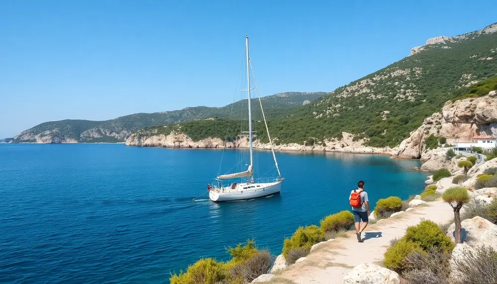
Return to the harbour before the scheduled 1 p.m. departure. The ship leaves after lunch, and the first coastal views begin almost at once. As Split fades behind you, the city walls give way to open water, pale limestone slopes, and the layered outline of the Dalmatian coast. It is a fine moment to settle into the rhythm of the cruise: landfall, trail, sea, then another island.
Keep your first afternoon light. The following stop on Šolta introduces the walking pace, the island terrain, and the practical routine of moving between vessel and trail. Comfortable shoes should be ready before arrival, not buried in the main luggage. That small bit of foresight saves time—and a surprising amount of rummaging.
Šolta on Foot: From Stomorska to Gornje Selo
Šolta offers a gentle but active first landing after leaving Split. The route links the harbour village of Stomorska with Gornje Selo, crossing the island’s quieter interior instead of staying beside the waterfront. At around 8 km, it is a substantial opening walk, yet the pace remains manageable for hikers with a reasonable base of fitness.
The path rises through the island landscape, with roughly 250 metres of ascent. Dry-stone walls, low Mediterranean vegetation, and small cultivated plots shape much of the walk. These walls are more than picturesque details: they mark old boundaries and show how island communities worked with thin soil and limited fresh water. Look closely and the scenery becomes less postcard-like, more like a living record of rural life.
Gornje Selo sits inland, away from the bustle of the coast. Reaching it gives the walk a useful sense of progression. You begin beside the sea, then move uphill through a slower, more secluded landscape before gaining views back towards the Dalmatian mainland. On clear days, the contrast is striking: bright limestone, deep blue water, and a horizon that seems to stretch forever.
The hike takes about 2.5 hours, although pauses, heat, and group pace can change the timing. Morning temperatures are usually kinder than the strong midday sun, so carry water even when the route looks short on paper. A hat, sunscreen, and shoes with firm grip matter here; smooth trainers can feel rather flimsy on uneven stone.
Šolta is not the dramatic finale of the voyage. That is precisely its charm. It eases you into island walking, reveals a more rural side of the Adriatic, and leaves enough energy for the sea, the ship, and whatever comes next.
Key Stops, Hiking Routes, and Practical Highlights
| Destination | Route | Distance | Walking Time | Ascent | Trail Highlights |
|---|---|---|---|---|---|
| Šolta | Stomorska to Gornje Selo | 8 km | About 2.5 hours | 250 m | Dry-stone walls, Mediterranean vegetation, rural island scenery, and views towards the mainland |
| Vis | Guided island trail | 7 km | About 2 hours | 250 m | Rocky tracks, traditional settlements, military-history traces, seafood, capers, grapes, and local pogača |
| Vela Luka, Korčula | Hike to Vela Spilja | 8 km | About 3 hours | 360 m | Archaeological cave, exposed limestone paths, prehistoric remains, and the most demanding listed climb |
| Stari Grad, Hvar | Trail to Purkin Kuk | 6 km | About 2.5 hours | 250 m | Ancient stone paths, megalithic fortifications, dry-stone walls, and views of the Stari Grad Plain |
| Bol, Brač | Coastal exploration | Not specified | Flexible | Varies | Zlatni Rat, bright limestone scenery, exposed shoreline, and views towards Vidova Gora |
| Makarska | Coastal walk to Nugal Beach | 5 km | About 1.5 hours | 116 m | Pine shade, rocky bays, quieter coastline, swimming opportunities, and Biokovo mountain views |
Vis: Remote Trails, Local Traditions, and Island History
Vis feels different from the busier islands on the Dalmatian route. Its distance from the mainland helped preserve a slower pace, stone villages, uncrowded coves, and a strong connection to fishing and farming. The island also served as a military zone for much of the 20th century, so its landscape carries a curious mix of wild nature and recent history.
The hike covers about 7 km, takes roughly 2 hours, and includes around 250 metres of ascent. Expect rocky tracks, pale limestone, dry hillsides, and stretches where shade is scarce. The distance is moderate, but uneven ground can make the walk feel more demanding than the figures suggest. Good grip matters, especially on loose gravel and worn stone.
Vis rewards a curious eye. Traditional settlements, old paths, and low stone enclosures reveal how islanders used the land before modern roads changed daily life. The route may also reflect the island’s military past, whose traces include concealed positions, roads, and structures built for strategic use. These remnants are easy to miss, which is exactly why a local guide adds value.
Food is part of the island’s identity too. Vis is known for seafood, capers, grapes, and the local flatbread called pogača. It is a simple, savoury dish, often linked with the island’s fishing culture. After walking, such flavours make more sense than a generic restaurant meal ever could. You have seen the terrain, felt the wind, and earned your lunch—fair enough.
Plan for sun protection and steady hydration. On exposed sections, the heat can build quickly even when the sea breeze feels pleasant. The best approach is unhurried: follow the guide, pause at viewpoints, and let Vis reveal its quieter character rather than rushing from one landmark to the next.
Vela Luka: Hiking to Vela Spilja on Korčula
Vela Luka marks a more demanding inland adventure on Korčula. The route covers about 8 km, lasts close to 3 hours, and gains roughly 360 metres. That combination makes this one of the stronger walking days, even though the distance itself may look modest.
The destination is Vela Spilja, known as the “Great Cave”. This archaeological site sits above Vela Luka and offers more than a scenic stop. Evidence from the cave points to human activity over thousands of years, making it a useful window into prehistoric life on the island. The cavern’s position also changes the character of the hike: the route feels like a gradual passage from the harbour into Korčula’s older, rougher landscape.
The climb can include rocky tracks, exposed sections, and irregular surfaces. In practical terms, the ascent matters more than the kilometre count. A steady pace is wiser than pushing hard early on, especially when the heat is high. Trekking poles may help hikers who prefer extra stability on the descent.
The guide may adjust the route to match the group’s fitness and the available time. This flexibility is useful, but it also means that the published figures should be treated as a planning guide rather than a fixed promise. Ask about the expected terrain before setting out, particularly if you have knee, ankle, or balance concerns.
- Allow extra effort for the 360-metre climb.
- Carry more water than you think you need for an exposed three-hour walk.
- Wear shoes with a firm sole and reliable grip.
- Bring a small headlamp if cave access or darker interior sections are included.
- Keep some energy for the return journey; the descent can be deceptively tiring.
Vela Spilja gives the day its sense of discovery. Rather than simply following a coastal footpath, hikers reach a place where geology, archaeology, and island life meet. It is a rugged, rewarding detour from the obvious Adriatic postcard—and that is the whole point.
Stari Grad: Stone Paths, Purkin Kuk, and Ancient Walls
Stari Grad brings Hvar’s deeper past into the walking route. The trail leaves the harbour and follows old paths towards Purkin Kuk, where dry-stone boundaries and rough coastal terrain show how earlier island communities shaped the land without heavy machinery. The scenery feels quiet, but it is far from empty of meaning.
The walk covers about 6 km, with approximately 250 metres of ascent, and takes close to 2.5 hours. Expect a mix of firm tracks, uneven limestone, and sections bordered by traditional stone walls. Those walls were built piece by piece to clear fields, contain animals, and divide plots. They also create a natural maze, so staying with the guide is sensible when several paths appear to meet.
Purkin Kuk is associated with a fortified settlement whose large megalithic blocks point to an ancient defensive purpose. The site offers a useful reminder that Hvar’s history did not begin with Venetian towns or modern tourism. Long before either, people watched the coast, protected valuable land, and built with the material beneath their feet.
The route’s appeal lies in its layers. One moment you walk between low walls and scrub; the next, the path opens towards the sea and the cultivated Stari Grad Plain. This plain is one of the Adriatic’s clearest examples of an ancient agricultural landscape, with field divisions that preserve a very old pattern of land use. It is a subtle view, not a loud one—but it stays with you.
Take time at the archaeological points rather than treating them as quick photo stops. The stones are irregular, weathered, and easy to underestimate. A guide can explain how settlement, farming, and defence fit together, turning a pleasant hike into a sharper reading of Hvar’s cultural landscape. Later, the planned Captain’s Dinner adds a fitting close to a day centred on the island’s long relationship with the sea.
Bol and Makarska: Coastal Views, Quiet Bays, and Scenic Trails
Bol brings a sharper coastal character to the route. The town lies on Brač’s southern shore, where steep mountain slopes meet the Adriatic and the shoreline opens towards the long, narrow shape of Zlatni Rat. Its changing tip is shaped by wind, waves, and currents, so the beach rarely looks quite the same twice.
Bol is a good place to notice how exposed the island landscape can be. White stone, low scrub, and intense sunlight create a bright, almost stark setting. The nearby Vidova Gora rises to about 778 metres, the highest point in the Adriatic islands. Even when the walking programme does not include its full summit trail, the mountain gives the coastline its dramatic scale.
Makarska shifts the mood from island solitude to mainland scenery. The town sits below the Biokovo range, with the sea in front and rugged mountain walls behind. A coastal walk towards Nugal Beach covers around 5 km, takes about 1.5 hours, and gains approximately 116 metres. It is the shortest listed hike, but the rocky approach and warm conditions still call for care.
Nugal is reached along a less urban stretch of coast. Pine shade, bare rock, and small bays replace the promenade, creating a sense of escape close to town. Access can be uneven, and beach conditions may change with waves or weather. Treat the stop as a natural viewpoint and swimming option, not as a fully serviced beach.
- Carry water during the walk from Makarska.
- Use footwear that handles loose stone and short, steep sections.
- Bring swimwear, but keep a towel and valuables secure on the boat.
- Allow extra time for photographs around Bol’s exposed shoreline.
- Expect strong sun even when the sea breeze feels cool.
Together, Bol and Makarska show two sides of the same coast: an island shaped by wind and pale limestone, then a mainland setting framed by the Biokovo mountains. The scenery is not hidden because it is remote. It feels off the beaten path because the walking routes reveal quieter edges just beyond the obvious waterfront.
What Each Day Feels Like: Distance, Time, and Elevation
The route averages about 6.4 km and 2.4 hours of walking per day, with roughly 241 metres of ascent. Those figures look modest, but island terrain rarely behaves like a neat treadmill. Stone, heat, short climbs, and uneven descents can change how a day feels.
- Šolta: 8 km, 2.5 hours, 250 m ascent. A steady opening day with a clear rhythm of climbing and walking.
- Vis: 7 km, 2 hours, 250 m ascent. Shorter in time, but still active because the elevation is concentrated.
- Vela Luka: 8 km, 3 hours, 360 m ascent. The biggest listed climb and the day most likely to test your legs.
- Stari Grad: about 6 km, 2.5 hours, 250 m ascent. A balanced route with enough height gain to keep the walk engaging.
The useful lesson is to judge the walks by ascent per hour, not distance alone. Vela Luka, for example, has only the same stated distance as Šolta, yet adds 110 metres more climbing and an extra half-hour on the trail. That difference is noticeable, especially on warm afternoons or after a restless night at sea.
Walking time also excludes some real-world pauses. A guide may stop for archaeology, viewpoints, directions, or a regrouping. Allow an extra 30 to 60 minutes in your day plan, particularly when the route includes exposed ground or a descent over loose rock.
A practical pacing strategy works best:
- Start slowly for the first 20 minutes and let your breathing settle.
- Use short steps on climbs instead of chasing the front of the group.
- Drink before you feel thirsty, not after.
- Keep a small snack for days with 300 metres or more of ascent.
- Save energy for descents, which can place more strain on knees than steady uphill walking.
In short, the programme suits hikers with a sound basic fitness level, not complete beginners who rarely walk on rough ground. You do not need mountain-racing speed. You do need to walk comfortably for three hours, climb several hundred metres, and remain sure-footed when the path turns stony.
Life on Board: Meals, Swimming Stops, Cabins, and Relaxation
Life on board works best as a recovery cycle between active shore days. Breakfast and lunch are provided each day, giving hikers reliable meals without searching for a restaurant before or after a walk. Breakfast can be used to build a practical trail plate: fruit, carbohydrates, and protein are more useful than relying on coffee alone. At lunch, replace fluids and salt after time in the sun.
Swimming stops add a welcome reset. A short dip can cool the body, loosen tired legs, and break up the travel day without demanding another excursion. Keep a dry bag or small pouch for swimwear, sunscreen, sunglasses, and any medication. Wet gear left in a closed suitcase turns unpleasant very quickly—no mystery there.
The ship also provides a calmer base than a hotel-hopping itinerary. You unpack once, keep the same cabin throughout, and return to a familiar space after each landing. Reviews commonly praise the clean cabins, generous meals, and attentive crew. Still, cabin comfort depends on location: lower-deck rooms may feel steadier, while cabins nearer shared areas can offer easier access but more movement and noise.
Use the quiet periods between ports deliberately. A shaded deck is ideal for reading, stretching, or simply watching the islands slide past. After a longer hike, gentle ankle circles and a few minutes of easy walking can reduce stiffness before dinner. If the sea is unsettled, keep meals small, stay near the centre of the vessel, and look towards the horizon rather than down at a screen.
- Pack a separate day bag for shore activities.
- Bring a refillable bottle and confirm where drinking water is available.
- Dry swimwear in open air instead of leaving it in the cabin bathroom.
- Use the deck’s shade during the strongest afternoon sun.
- Ask the crew early about dietary needs or meal changes.
The social side matters, too. Shared meals and evenings on deck make solo travellers part of the group without forcing constant conversation. Some guests prefer cocktails and company; others need an early night. Both choices fit the rhythm of an active cruise. The real luxury is not endless entertainment, but having sea, food, shelter, and a familiar bed waiting after the trail.
Who This Moderate Hike Cruise Suits—and How to Prepare
This moderate hike cruise suits travellers who want real trail time without giving up a comfortable base at sea. You should be able to walk for up to three hours, manage repeated climbs, and stay steady on uneven limestone. Previous alpine experience is not required, but a normal city stroll is not enough preparation either.
It can work well for active couples, solo travellers, and mixed-age groups with similar expectations. The guided format helps with navigation and pacing, while route adjustments may support different fitness levels. However, anyone with a recent injury, heart condition, severe vertigo, or limited balance should seek medical advice before booking.
Prepare for the specific demands of island walking, not just the distance. Build up over four to six weeks with brisk walks, stairs, and one longer outing each week. Add simple strength work for calves, thighs, hips, and core. A useful target is a continuous three-hour walk on uneven ground with several sustained climbs.
- Footwear: Choose broken-in hiking shoes with a firm, grippy sole. Avoid new boots on the first trail day.
- Clothing: Use light layers, breathable fabrics, and a thin wind shell for changing coastal conditions.
- Personal kit: Pack blister plasters, basic pain relief, insect repellent, a compact first-aid kit, and any prescription medication.
- Navigation: Keep the guide’s contact details and the ship’s meeting instructions offline on your phone.
- Recovery: Bring a small massage ball or resistance band if your legs often tighten after climbs.
Check your travel insurance carefully. It should cover hiking at the stated difficulty, medical treatment, evacuation, and itinerary changes caused by transport disruption. Travel with a copy of your policy and a list of important medical details; it is dull admin, admittedly, but useful when things go sideways.
Choose the cruise if you enjoy a clear daily structure and shared activity. Choose another type of holiday if you need fully private walking times, flat paths, or complete control over every port. The best match is a traveller who welcomes a little effort, accepts flexible plans, and sees comfort as support for adventure—not a substitute for it.
Weather Changes, Flexible Routes, and Practical Check-In Tips
Adriatic weather can change faster than a printed itinerary. A calm morning may turn windy by afternoon, while rain, swell, or a harbour restriction can affect both the sailing plan and the shore programme. The crew may therefore change a port, shorten a route, alter the order of activities, or replace a walk. Flexibility is part of the adventure, not a sign that the trip is poorly planned.
Wind deserves special attention. Strong jugo winds can bring cloud, rain, and rougher seas, while dry northerly winds may produce cooler air and sharper visibility. Heat is another concern on exposed trails. A forecast that looks comfortable at the harbour can feel much stronger on pale limestone with little shade.
Check the forecast again on the evening before each hike, but do not treat a phone app as the final decision-maker. Local guides and the captain can read sea conditions, access limits, and trail safety better than a generic weather icon. If the plan changes, ask three practical questions: What is the new meeting point? How long is the alternative walk? Which items should remain with you on shore?
- Bring a light waterproof layer, even during the warmer season.
- Keep sun protection and warm clothing accessible, rather than buried in luggage.
- Use a dry pouch for passports, cash, phones, and electronics during wet weather.
- Expect swimming stops to move or disappear when sea conditions are unsafe.
- Do not leave the ship for a walk without confirming the return time and meeting place.
For check-in, keep your booking details and identification ready before reaching the port. The stated arrival window is 10:30 a.m. to noon, with departure at 1 p.m. Late arrivals create little margin because harbour procedures and loading must be completed before sailing. If your flight or bus reaches Split close to noon, build in a backup plan; traffic and summer queues can be surprisingly stubborn.
Cabin access may follow later than check-in. Pack a small arrival bag with essentials for the first hours, including medication, a change of clothes, swimwear, and valuables. Label your main bag clearly, and avoid placing items needed on deck inside it. Simple, yes—but it keeps the first transition calm when the port is busy.
Before every shore excursion, confirm the weather decision, route length, terrain, meeting time, and emergency contact method. A revised plan can still produce an excellent day, perhaps an even more memorable one. The key is to treat the schedule as a safe framework rather than a contract with the sea.
Traveller Feedback: Guides, Crew, Food, and Comfort
Traveller feedback points to a clear strength: the people often shape the experience as much as the landscapes. Guests repeatedly mention guides who explain the route well, share local knowledge, and choose rewarding viewpoints rather than simply leading a group from A to B. That matters on island trails, where a small historical detail or a safer line across loose ground can change the whole walk.
Reviews also describe the crew as attentive without becoming intrusive. Help with daily questions, clear activity information, and a relaxed attitude appear often in positive accounts. For solo travellers, this practical warmth can make the cruise feel easy to join. Shared meals and international company create social contact, while guests can still keep to themselves when they need a quiet evening.
Food receives strong marks across the feedback. Travellers highlight generous portions and meals that feel fresh rather than merely functional after a day outdoors. This is important because the schedule combines walking, swimming, and sailing; a light snack-only approach would leave many hikers running on fumes by the afternoon. Dietary requests should still be raised before departure, since onboard menus and provisioning may vary.
Comfort reviews are broadly positive, especially for cleanliness, cabin space, and the condition of the vessel. The experience is not a resort stay with unlimited room or silence. Cabins remain part of a working ship, and motion, engine sounds, or shared onboard areas can affect sleep. That trade-off is worth stating plainly: travellers gain a stable base and avoid daily hotel changes, but they also live within a compact maritime setting.
The feedback includes useful cautions as well as praise:
- Some guests found onboard wine prices high and wanted a simpler, lower-cost option.
- Activity schedules may feel structured for travellers who prefer long, unplanned stops ashore.
- Returning to the ship for lunch can reduce time for independent exploration on certain active itineraries.
- Group ages and walking speeds may differ, so expectations should be discussed early.
Overall, the reviews suggest a strong fit for travellers who value human service, guided discovery, dependable meals, and an easy social atmosphere. They are less persuasive for anyone seeking complete independence, extensive nightlife, or a fully flexible day plan. That distinction is useful. A good holiday review should not only celebrate what worked; it should help the next traveller decide whether the rhythm feels right for them.
Conclusion: Pack for Moderate Trails and Sail Croatia’s Hidden Landscapes
Choose this adventure if you want the Adriatic to feel active, close, and pleasantly unscripted. The strongest appeal is the contrast: a demanding trail can lead to a quiet cove, an ancient site, or a view that is impossible to reach from a standard sightseeing stop.
Pack for changing surfaces and changing plans. A reliable daypack, broken-in trail shoes, sun protection, a refillable bottle, and a light weather layer will serve you better than bulky gear. Keep documents, medication, and electronics protected from spray and sudden rain.
For the 2026 and 2027 sailing seasons, confirm the exact itinerary, ship, inclusions, and departure instructions before payment. Published route details can differ between standard and luxury departures, while weather and harbour conditions may still affect the final programme. Treat the schedule as a strong framework, not a promise carved in stone.
The right mindset matters most. You will not see every island from a road, nor will every day unfold perfectly. That is the charm. If you can accept moderate effort, shared rhythms, and the occasional change of course, this journey offers a rare way to explore Dalmatia: slowly enough to notice it, and actively enough to remember it.
Frequently Asked Questions About Hiking and Sailing in Croatia
What is a hike cruise in Croatia?
A hike cruise combines guided walks through Croatia’s islands and coastal landscapes with travel aboard a small cruise ship. Travellers can explore places such as Šolta, Vis, Korčula, Hvar, Brač, and the Makarska coast while unpacking only once during the journey.
How difficult are the hikes on a Croatian hike cruise?
The hikes are generally rated moderate and require a reasonable level of fitness. Walks typically cover about 5 to 8 kilometres, take approximately 1.5 to 3 hours, and include uneven limestone paths and ascents of up to around 360 metres.
Which landscapes and historical sites can travellers see?
The routes include dry-stone walls on Šolta, traditional settlements and military-history traces on Vis, the archaeological cave Vela Spilja on Korčula, the megalithic site of Purkin Kuk near Stari Grad, Zlatni Rat near Bol, and the coastal path to Nugal Beach near Makarska.
What should I pack for the hikes?
Pack broken-in hiking shoes with good grip, a refillable water bottle, sun protection, breathable clothing, a light waterproof or windproof layer, swimwear, personal medication, blister plasters, and a small daypack. A dry pouch is useful for protecting valuables from spray or rain.
Can the itinerary change during the cruise?
Yes. Weather, sea conditions, and harbour restrictions can affect sailing times, port calls, walking routes, or swimming stops. The captain and local guides may adjust the programme to keep the group safe and adapt the experience to current conditions.