Table of Contents:
Top Trekking Routes in the Spanish Pyrenees: Difficulty Levels, Distances, and Terrain
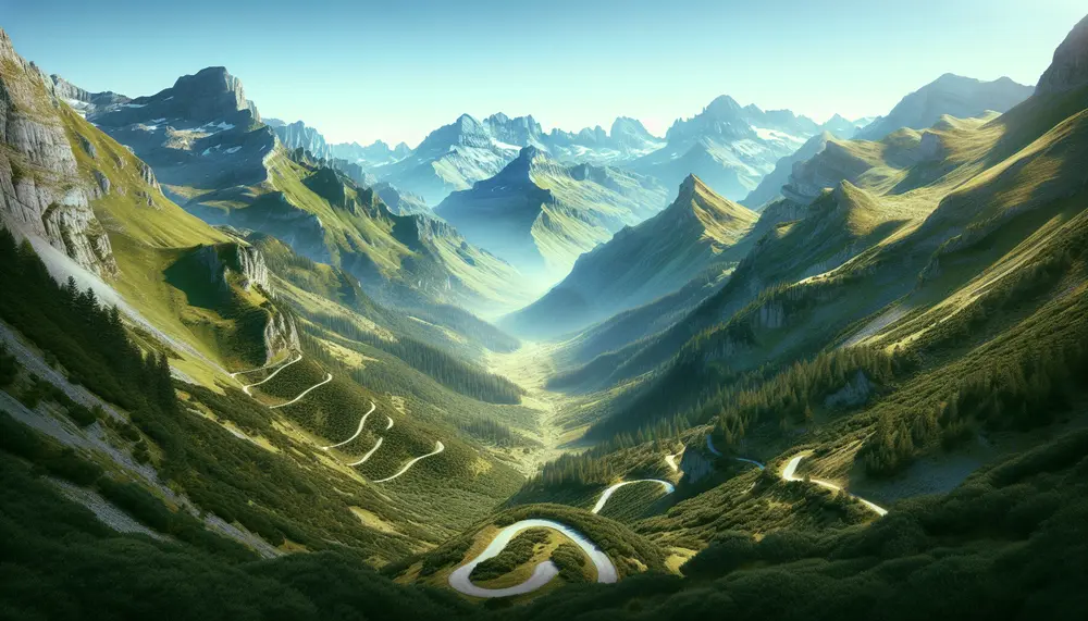
The Spanish Pyrenees offer some of Europe's most technically demanding and scenically rewarding trekking terrain, stretching roughly 430 kilometers from the Atlantic foothills of Navarra to the Mediterranean slopes of Catalonia. Elevation changes here are unforgiving — you're regularly dealing with ascents exceeding 1,200 meters in a single day — yet the diversity of landscapes, from glacially carved cirques to ancient beech forests, makes every kilometer worth the effort. Whether you're planning a week-long traverse or targeting specific peak circuits, understanding the route characteristics before you leave the trailhead is non-negotiable.
Classic Long-Distance Routes: GR11 and Its Variants
The GR11 (Senda Pirenaica) is the backbone of Pyrenean trekking on the Spanish side, covering approximately 820 kilometers with a cumulative elevation gain exceeding 47,000 meters over its full length. Completed in 40–45 days by experienced trekkers moving at pace, it runs entirely within Spanish territory unlike its French counterpart the GR10. The terrain shifts dramatically by section: the western Navarrese stretches involve rolling ridgelines and abundant water sources, while the central Aragonese segments — particularly around the Ordesa y Monte Perdido National Park — deliver brutal limestone gorges and exposed ridge scrambles above 3,000 meters. The eastern Catalan sections reward with the rugged Aigüestortes landscape, where granite dominates and lake-hopping becomes a daily rhythm. If you want a deeper look at how altitude and water interact to shape the experience, the transition from high alpine terrain to rushing mountain streams defines the rhythm of multi-day trekking here.
Shorter Technical Circuits Worth Knowing
Not every exceptional route requires two weeks on trail. The Aneto Circuit in the Benasque Valley — a 3-day, 52-kilometer loop around the highest peak in the Pyrenees (3,404 m) — delivers glacier approach terrain, moraines, and high-altitude passes including the Portillón Superior at 3,079 m. This is a Grade 3 route demanding crampons and ice axe competence in pre-July conditions. The Circo de Soaso day route within Ordesa covers 16 kilometers with 600 meters of gain, making it accessible for fit hikers without technical gear, yet the sheer limestone walls rising 1,000 meters above the canyon floor create an atmosphere unmatched anywhere in the range. For those drawn to the wilder, less-trafficked corners where the landscape feels genuinely untouched, the remote valleys of the Spanish Pyrenees hold circuits that see fewer than 200 hikers annually.
Terrain classification in the Pyrenees follows a practical split: sendero (marked trail), alta montaña (high mountain requiring navigation skills), and vía ferrata or scramble (requiring hand-over-foot movement). Many routes combine all three within a single day, which catches underprepared trekkers off guard. The Vignemale approaches from the Spanish side exemplify this — a seemingly straightforward valley walk transforms into a technical glacier crossing within 4 kilometers. Planning routes that move through contrasting elevation zones demands honest self-assessment of fitness and technical competence, not just ambition.
- GR11 full traverse: ~820 km, 40–45 days, Grade 3–4 overall
- Aneto Circuit: 52 km, 3 days, Grade 3 (technical snow in spring)
- Circo de Soaso (Ordesa): 16 km, 600 m gain, Grade 1–2
- Aigüestortes Lake Circuit: 35 km, 2 days, Grade 2, best mid-July to September
- Monte Perdido South Face: 22 km day route, 1,500 m gain, Grade 3
Rock Climbing, Via Ferrata, and Vertical Adventures: Best Crags and Grades in Aragón and Catalonia
The Spanish Pyrenees pack an extraordinary density of vertical terrain into a relatively compact mountain range, offering limestone sport routes, multi-pitch trad lines, and via ferrata circuits that rival anything the Alps can offer — often with far fewer crowds. The combination of reliable summer weather, well-developed approach trails, and a climbing culture dating back to the 1970s makes Aragón and Catalonia the beating heart of Spanish high-altitude climbing. Whether you're projecting a 7c sport route or guiding a group of beginners up an equipped iron path, the range delivers at every level.
Premier Crags and Climbing Areas
Riglos, located in the Pre-Pyrenees of Aragón, is perhaps the most iconic destination — its conglomerate "mallos" towers rise 300 meters above the village of Murillo de Gállego. Routes like Fiesta de los Bichos (6b+) offer sustained technical climbing on featured conglomerate with exposure that demands a steady head. The rock quality here differs dramatically from limestone, requiring specific footwork and trust in hollow-sounding holds that are far more solid than they sound. Expect grades from 4 to 8b, with the majority of classics sitting in the 5+ to 7a range.
In Catalonia, Àger in the Lleida Pre-Pyrenees provides arguably the finest single limestone crag in the Iberian Peninsula. The Sector Montsec hosts over 400 routes on immaculate grey limestone, with most lines bolted to modern standards. Approach times rarely exceed 20 minutes, and south-facing walls mean climbing is viable from March through November. Routes in the 6a to 7b range dominate, making Àger ideal for intermediate climbers looking to push their grade in ideal conditions. For a broader view of how climbing connects with other mountain pursuits, the transition from high crags down to river-level adventures is something many visitors combine into multi-day itineraries.
Via Ferrata: Iron Routes for Every Level
Via ferrata infrastructure across the Pyrenees has expanded dramatically since 2010, with over 60 equipped routes now documented across both regions. The Vía Ferrata del Puro in the Hecho Valley (Aragón) offers a genuine mountaineering experience at D/MD difficulty, with a 400-meter vertical gain on exposed ridgelines above 2,000 meters. The Gorges de Collegats circuit in Catalonia represents the opposite end of the spectrum — a scenic F/PD-rated route accessible to families with basic fitness, threading through river-carved limestone canyons.
- Essential gear: Full via ferrata set with energy-absorbing lanyard, helmet, and gloves for iron rungs
- Best season: June through September for high-altitude routes; April–May and October for lower Pre-Pyrenees crags
- Grade system: Spanish via ferrata uses F (Fácil) through ED (Extremadamente Difícil) — confirm local grading before committing
- Guided options: UIAGM-certified guides operate from Benasque, Ainsa, and Sort for both sport climbing and via ferrata instruction
Rock quality, route density, and logistical accessibility make the Pyrenean crags genuinely world-class. The key is understanding that limestone sectors like Àger and Peña Montañesa reward different technique than the conglomerate towers of Riglos — experienced climbers often plan separate trips to each. Those pushing into serious alpine terrain will find that multi-pitch skills developed on Riglos translate directly to the larger north-face routes above 3,000 meters in the Maladeta and Posets massifs.
Pros and Cons of Adventures in the Spanish Pyrenees
| Pros | Cons |
|---|---|
| Diverse terrain for trekking, climbing, and skiing | Weather can change rapidly, requiring careful planning |
| Less commercialized than the French side, offering raw natural beauty | Technical routes demand high fitness and skills |
| Extensive trails and long-distance routes like GR11 | Limited access to some areas due to park regulations |
| Rich biodiversity with unique flora and fauna | Potential avalanche risks in winter and spring |
| Vibrant local culture and gastronomy | Crowds during peak tourist seasons and holidays |
White Water Rafting and Kayaking in the Pyrenean Rivers: Noguera Pallaresa, Gállego, and Beyond
The Spanish Pyrenees harbor some of Europe's most technically demanding and scenically spectacular whitewater. Snowmelt from peaks above 3,000 meters feeds rivers that drop hundreds of meters over relatively short distances, creating hydraulics that challenge beginners and elite paddlers alike. If you've already explored how the mountains transition into these powerful river corridors, you'll understand why the drainage systems here produce such consistent, high-quality runs across a remarkably long season — typically April through September, with peak flows in May and June.
The Noguera Pallaresa: Spain's Whitewater Capital
The Noguera Pallaresa in Catalonia is the undisputed benchmark for Pyrenean paddling. The stretch between Llavorsí and Rialp — roughly 22 kilometers — contains rapids graded from Class III to Class V, making it suitable for both commercial rafting groups and technical kayakers running lines like the notorious Canal d'en Rabics. The town of Sort has built its entire economy around river sports, hosting the annual Descens Internacional de l'Aigüa each June, which draws professional teams from across Europe. Water temperatures in May average around 8-12°C, so a 5mm wetsuit minimum is non-negotiable regardless of air temperature. Commercial operators in Sort typically charge €35-55 per person for a half-day raft, with discounts for groups above eight.
For kayakers specifically, the upper Noguera above Llavorsí offers continuous Class IV-V creeking in a gorge environment that demands solid roll mechanics and prior experience in committing moves. Portaging some of the harder drops is possible but awkward. Renting a creek boat locally runs approximately €50 per day; most shops also offer guided descents with certified FFFE (French Canoe-Kayak Federation) or RFEP instructors for €80-120 per person.
The Gállego and Lesser-Known Alternatives
The Río Gállego in Aragón delivers a different character entirely. The canyon section between Sabiñánigo and Murillo de Gállego — about 35 kilometers — alternates between calm flatwater pools and abrupt Class III-IV drops, ideal for intermediate paddlers building river-reading skills. The Cañón de Guara section near Riglos is particularly striking, with limestone walls rising directly from the water and the famous Mallos de Riglos monoliths visible on the skyline. Flow data for the Gállego is publicly available through the SAIH Ebro monitoring system, and paddlers should target readings between 15-40 m³/s for optimal conditions.
Beyond these two headline rivers, the Ésera, Ara, and Segre offer compelling alternatives depending on seasonal conditions and skill level. The Ara between Broto and Ainsa remains one of the most aesthetically pure runs in the Pyrenees, threading through a landscape of extraordinary ecological richness with lammergeiers regularly visible overhead. Flows on the Ara are less regulated than the Noguera Pallaresa, making real-time gauge checking essential before committing to a descent.
- Best beginner river: Noguera Pallaresa (Llavorsí–Rialp) with a commercial operator
- Best intermediate run: Gállego canyon section, targeting flows 20-35 m³/s
- Best expert creek: Upper Noguera Pallaresa above Llavorsí, Class IV-V
- Peak season: Mid-May to late June for maximum snowmelt volume
- Essential gear: Helmet, PFD, wetsuit, and throw rope — even on commercial trips
One practical note: Spanish river outfitters are legally required to provide certified guides for commercial descents, but self-guided kayakers have no mandatory permit system. That freedom carries responsibility — always register your float plan with local emergency services when running committing gorge sections alone or in small groups.
Ski Resorts vs. Backcountry Skiing in the Spanish Pyrenees: A Comparative Guide for Winter Adventurers
The Spanish Pyrenees offer two fundamentally different winter experiences that attract distinct types of skiers — and choosing the wrong one for your skill set or expectations can make or break your trip. With over 30 ski resorts spread across Catalonia, Aragon, and Navarra, and hundreds of kilometers of untracked backcountry terrain above 2,500 meters, the range is staggering. Understanding the trade-offs is essential before you book a single lift ticket or pack your beacon.
Ski Resorts: Infrastructure, Consistency, and Accessible Terrain
The resort scene in the Spanish Pyrenees is anchored by heavyweights like Baqueira-Beret in Val d'Aran, which covers 167 km of marked runs across three valleys and regularly receives 6–8 meters of cumulative snowfall per season. Grandvalira (technically Andorra but accessed through the Spanish Pyrenees corridor) and Cerler near Benasque are strong alternatives. Lift-accessed skiing here means reliable grooming, ski patrol coverage, and on-piste variety from gentle blues at 1,500 m to steep blacks above 2,600 m. Resort skiing suits families, intermediates looking to build mileage, and anyone wanting après-ski culture without logistical complexity.
- Season window: Most resorts operate December through April, with peak conditions typically mid-January to mid-March
- Cost benchmark: Day passes at Baqueira-Beret run €50–€65; multi-day packages drop the per-day cost by roughly 25%
- Crowds: Spanish national holidays — especially Semana Blanca in February — bring heavy lift queues; mid-week visits in January are dramatically quieter
Backcountry Skiing: Commitment, Reward, and Real Risk
For those drawn to the raw, exposed ridgelines and couloirs of the high Pyrenees, backcountry skiing delivers an entirely different proposition. The massifs of Posets-Maladeta and Ordesa-Monte Perdido harbor serious ski mountaineering routes where 1,200 m vertical descents on untracked powder are achievable — but only with proper avalanche training, beacon/probe/shovel kit, and ideally a certified mountain guide. The avalanche risk here is real: the Pyrenees see 3–5 avalanche fatalities annually, with the majority involving unguided parties without avalanche education.
The payoff is extraordinary. Routes like the Aneto glacier approach or the north-facing couloirs above Benasque Valley offer the kind of vertical adventure that transitions seamlessly from alpine snowfields down into river valley landscapes few lift-accessed skiers ever witness. Snowpack in these zones is highly variable — maritime Atlantic systems dump heavy wet snow on the western ranges, while the eastern Pyrenees experience a more continental, drier snowpack. Knowing which sector suits your preferred snow texture matters.
A practical middle ground gaining popularity is guided ski touring with hut-to-hut itineraries through the GR11 corridor. Operators like Compañía de Guías de Benasque run 3–5 day circuits averaging 15–20 km daily with 800–1,200 m of skinning. This format introduces backcountry terrain progressively while eliminating the navigation and safety burden for less experienced parties. If you're genuinely interested in exploring the wilderness character of these mountains in winter, a guided tour is the most responsible entry point.
- Essential gear beyond skis: Avalanche transceiver, probe, shovel, crampons, ice axe for steeper routes above 2,800 m
- Weather window: Check AEMET's mountain forecast — weather systems move fast; a clear morning can deteriorate within 3 hours above 2,000 m
- Skill prerequisite: Confident off-piste skiing at resort level before attempting independent backcountry routes
Wildlife, Flora, and Protected Zones: Navigating Ordesa, Aigüestortes, and the Pyrenean National Parks
Spain's Pyrenean national parks represent some of the most rigorously protected ecosystems in Western Europe, and understanding their regulatory frameworks before you arrive is the difference between a seamless expedition and a frustrating encounter with park rangers. Ordesa y Monte Perdido National Park, established in 1918 as Spain's first national park, covers 15,608 hectares of dramatic canyon landscapes, while Aigüestortes i Estany de Sant Maurici in Catalonia protects 40,852 hectares of glacial lakes, cirques, and boreal forest. Both parks operate under strict zoning systems that divide terrain into core reserve areas, guided access zones, and peripheral protection buffers — knowing which zone you're entering determines what activities are permitted.
Key Species and Ecological Hotspots
The Pyrenees harbor a remarkably dense concentration of endemic and reintroduced megafauna. The Pyrenean chamois (Rupicapra pyrenaica) numbers approximately 30,000 individuals across the range, making it relatively easy to spot above 1,800 meters during morning and evening hours. More elusive is the brown bear (Ursus arctos): roughly 50-60 individuals now roam the central Pyrenees following reintroduction efforts since 1996, concentrated primarily in the Vall d'Aran and the Pallars Sobirà. Spotting one requires pre-dawn positioning near berry-rich slopes between August and October. Those drawn to the more remote corners of the range's untamed wilderness will also encounter griffon vultures, Egyptian vultures, and the reintroduced bearded vulture (Gypaetus barbatus), whose 2.8-meter wingspan makes it unmistakable in the thermals above Ordesa's canyon walls.
Flora zones in both parks follow strict altitudinal bands. Between 900 and 1,600 meters, silver fir and beech dominate, giving way to Scots pine and mountain pine up to 2,200 meters. Above treeline, the alpine meadows host over 160 endemic Pyrenean plant species, including Ramonda myconi, a resurrection plant unique to shaded limestone crevices throughout Ordesa. Picking any plant, even collecting fallen specimens, carries fines up to €1,000 in national park zones.
Practical Navigation of Access Rules
Both parks implement seasonal vehicle restrictions that catch unprepared visitors off guard. In Ordesa, the Pradera de Ordesa car park closes to private vehicles from mid-June through mid-September; mandatory shuttle buses operate from Torla-Ordesa starting at 6:00 AM. Aigüestortes requires park shuttle or authorized taxi access for the Boí and Espot entrances during peak season. Hikers planning multi-day traverses through the full spectrum of the Spanish Pyrenees' terrain from high ridges down to valley rivers must additionally obtain bivouac permits for overnight stays within core zones — apply through the respective park administration at least 15 days in advance during July and August.
- Camping: Strictly prohibited inside national park boundaries; designated campsites exist in peripheral zones only
- Drones: Banned entirely in both national parks without explicit scientific authorization
- Dogs: Prohibited on all trails within Ordesa; permitted on leash in Aigüestortes peripheral zones only
- Winter access: Several trails in Aigüestortes remain open year-round with snowshoes, but avalanche risk zones are marked and advisory closures are enforced
Visitors planning adventures that combine the dramatic elevation changes between high summits and deep valley systems should consult the PNOA topographic layers available through the Instituto Geográfico Nacional — these overlay official park boundaries and zoning designations directly onto 1:25,000 scale maps, which is the working standard for any serious route planning in these protected areas.
Mountain Safety, Weather Risks, and Gear Essentials for Pyrenees Expeditions
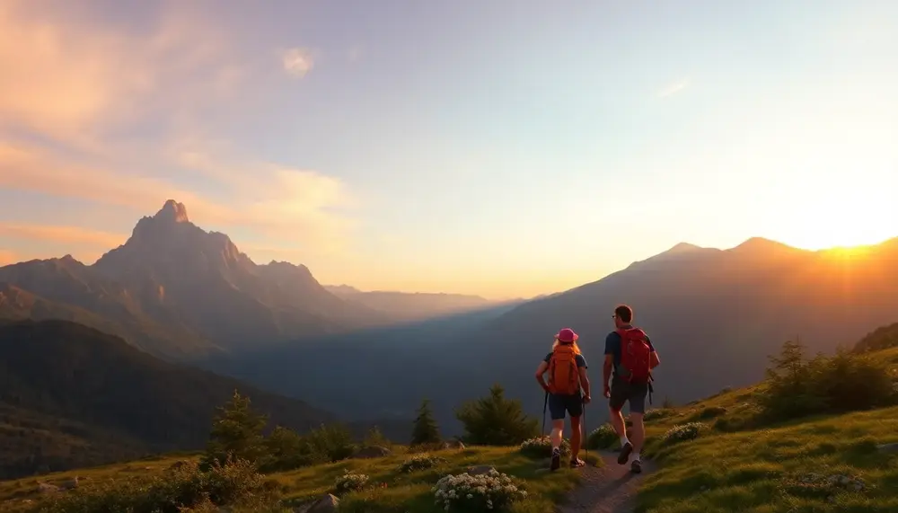
The Spanish Pyrenees demand respect. Every year, mountain rescue teams in Aragón and Catalonia respond to hundreds of incidents, many of them preventable with proper preparation. The range stretches over 430 kilometers and reaches elevations above 3,400 meters, creating microclimates that shift with alarming speed. Anyone planning to push into serious vertical terrain across the high ridgelines needs to understand that afternoon thunderstorms can materialize in under 90 minutes during July and August, leaving exposed hikers on granite ridges dangerously vulnerable to lightning strikes.
Reading Pyrenean Weather Patterns
Atlantic fronts approach from the northwest and typically arrive without much warning in the western massifs around Ansó and Hecho. Meanwhile, Mediterranean moisture builds convective storms from the east, particularly affecting the Catalan Pyrenees. The AEMET mountain forecasts (Spain's national meteorological agency) issue zone-specific bulletins updated twice daily — checking these at 6:00 AM before any summit attempt is non-negotiable. Wind speeds exceeding 80 km/h are not unusual on exposed cols above 2,800 meters even in summer, and snow can fall on Aneto above 3,000 meters during any month of the year.
Lightning risk in the central Pyrenees peaks between 13:00 and 17:00 during summer months. The rule practiced by experienced Pyrenean guides is simple: if you're not at the summit by 11:00 AM on a storm-prone day, you turn around. The granite and quartzite terrain conducts electrical charge efficiently, and ground current alone — not just a direct strike — can be lethal within 15 meters of a strike point.
Gear That Actually Matters at Elevation
The gear choices that separate prepared mountaineers from accident statistics are straightforward but often ignored by trekkers underestimating the range. For anything above 2,500 meters, the following items are essential rather than optional:
- 30-meter emergency bivouac bag — hypothermia onset in wet conditions above 2,000 meters can occur within 45 minutes without wind protection
- Trekking poles with snow baskets — critical for snowfield crossings on routes like the GR11 in May and June
- 10-point crampons and ice axe — mandatory for any ascent of Aneto, Posets, or Monte Perdido before late July
- Navigation redundancy — a pre-loaded GPS device plus 1:25,000 paper maps (Editorial Alpina series is the standard reference)
- Satellite communicator — mobile coverage drops to zero in most valleys above 1,800 meters
Hydration strategy is equally critical. High-altitude UV intensity combined with dry Pyrenean air causes dehydration rates 40% higher than lowland hiking. Carrying a water filtration system rather than relying solely on pre-filled bottles gives you flexibility on longer routes. The glacial streams and high tarns are generally clean above human settlement, but livestock grazing in summer pastures below 2,200 meters makes filtration essential at lower elevations.
For expeditions that combine high ridges with descents into river gorges — the kind of multi-day journey moving from alpine terrain down to rushing canyon streams — packing layers that transition effectively between cold summit winds and humid gorge environments is a specific challenge. Merino base layers and a hardshell rated to at least 20,000 mm hydrostatic head cover the full spectrum. Group size matters too: solo travel above 3,000 meters is strongly discouraged by Pirineo rescue coordinators, who consistently report that solo incidents have a 3x higher fatality rate than those involving pairs or small groups.
Cultural Immersion Along the Trail: Romanesque Villages, Pilgrim Routes, and Local Gastronomy
The Spanish Pyrenees are far more than a playground for physical challenge — they represent one of Europe's most concentrated corridors of living medieval culture. The mountain valleys of Aragón and Catalonia shelter over 150 documented Romanesque churches, many of them still active parish buildings in communities of fewer than 200 residents. Walking between these villages isn't sightseeing; it's time travel with sore legs.
Romanesque Architecture and the Pilgrim Network
The Camino Aragonés, which crosses the Pyrenees via the Somport Pass at 1,632 meters, predates the more famous Camino Francés by several centuries and carried the bulk of French pilgrims to Santiago de Compostela throughout the 11th and 12th centuries. The route passes directly through Jaca, whose cathedral — consecrated around 1063 — is considered the earliest example of Spanish Romanesque architecture. Spend at least two hours here, not just in the cathedral but in the adjoining Diocesan Museum, which houses rescued frescoes from abandoned mountain chapels; the collection rivals anything in Barcelona's MNAC. Further east, the Boí Valley in the Lleida Pyrenees contains nine UNESCO-listed Romanesque churches within a 10-kilometer radius — a density unmatched anywhere in Europe.
For those whose experience of the Pyrenees extends deep into the wilderness, integrating a cultural detour through the Hecho or Ansó valleys adds crucial context. These valleys maintained their own distinct dialect, Cheso, into the 20th century, and their stone villages — built without mortar in many sections — demonstrate a construction logic developed over 800 years of mountain winters.
What to Eat and Where
Pyrenean gastronomy is honest mountain food engineered for caloric endurance. Key dishes every trekker should eat at least once:
- Ternasco de Aragón — PDO-protected suckling lamb roasted with lard and garlic, best in Jaca or Hecho village restaurants
- Chireta — lamb intestines stuffed with rice and offal, a 14th-century recipe still served in Huesca province
- Crespillos de Borrajas — battered borage leaves fried in honey, a sweet found only in the Aragonese foothills
- Recuit de drap — Catalan fresh cheese wrapped in cloth, typically served with honey from local Pyrenean beehives
The local wine culture is underrated. The Somontano DO, produced at the Pyrenean foothills around Barbastro, produces structured reds from Moristel and Parraleta grapes that are nearly impossible to find outside Aragón. Buy directly from Bodegas Pirineos or Viñas del Vero — both offer cellar visits and their export volumes are minimal enough that what you drink here you genuinely cannot get elsewhere.
Timing matters enormously. The village of Torla-Ordesa hosts its medieval market in late August, coinciding with the Feast of San Bartolomé, and the Feria de Santa Orosia in Jaca (late June) features traditional Pyrenean dance forms — the jota aragonesa variants here differ measurably from lowland versions. Travelers planning multi-day routes across the high terrain should schedule valley rest days to align with these events rather than treating them as accidental encounters.
The cultural layer transforms what might otherwise be pure athletic endeavor. Those who approach the Pyrenees by moving fluidly between its vertical and horizontal landscapes consistently report that a single afternoon in a Romanesque cloister recalibrates their relationship to the entire mountain range.
Sustainable Adventure Tourism in the Pyrenees: Eco-Certifications, Low-Impact Practices, and Emerging Trends
The Spanish Pyrenees host roughly 3.5 million visitors annually, a figure that has grown by nearly 20% over the past decade. This pressure on a mountain ecosystem that shelters brown bears, bearded vultures, and over 3,500 plant species demands more than goodwill — it requires structured, verifiable sustainability frameworks. The good news is that the Aragonese and Catalan sections of the range are now at the forefront of certified responsible adventure tourism in southern Europe.
Eco-Certifications Worth Trusting
Not all green claims are equal. The Biosphere Responsible Tourism certification, administered by the Responsible Tourism Institute in Barcelona, is the most rigorous label you'll encounter from Pyrenean operators. It audits water usage, waste management, local supply chains, and guide training protocols. Operators like Barrancos Pirenaicos (based in Ainsa) and several rafting companies along the Noguera Pallaresa have held this certification for multiple consecutive cycles, which matters — annual renewal prevents greenwashing. The EU's EMAS (Eco-Management and Audit Scheme) is rarer but signifies the highest operational transparency; look for it at larger mountain refuges and multi-activity centers.
The Q de Calidad Turística issued by ICTE is a Spanish national standard that increasingly incorporates environmental benchmarks, though it remains weaker on ecological specifics than Biosphere certification. When booking, ask operators directly: What percentage of your guides are local? Do you contribute to the Fundación para la Conservación del Quebrantahuesos? These questions separate genuine practitioners from marketing-only actors.
Low-Impact Practices on the Ground
Seasoned Pyrenees travelers know that the region's true ecological richness — from glacial cirques to endemic flora — depends on strict behavioral protocols beyond trail etiquette. Group size limits are now enforced in sensitive zones: the Ordesa y Monte Perdido National Park caps guided groups at 12 participants for high-alpine routes during July and August. Bivouacking is prohibited below 1,800 meters in Catalonia's protected areas, a rule frequently ignored and increasingly fined (up to €600 per incident). Certified operators build these constraints into their logistics automatically; uncertified ones often don't.
Gear transport presents a less-discussed impact vector. Those who push into serious technical terrain across the range's high passes should know that helicopter supply flights to mountain huts emit roughly 4.5 kg CO₂ per kilogram of cargo versus mule transport at under 0.3 kg. Several refugios, including Góriz and La Renclusa, have shifted back to traditional supply methods precisely for this reason. Packing light isn't just personal discipline — it directly reduces demand for aerial resupply.
Water stewardship is another critical axis. Pyrenean rivers like the Ara and Ésera are already stressed by irrigation withdrawals; adventure activity wastewater adds microbial pressure. Responsible wet-sport operators use biodegradable wetsuits (neoprene alternatives from natural rubber) and enforce no-detergent gear washing in riparian zones — practices that serious multi-sport guides working across both summit and river environments have standardized as non-negotiable.
- Slow adventure formats — multi-day traverses replacing single-day peak-bagging — are growing at 15% per year among certified operators, reducing per-visit footprint significantly
- Carbon contribution schemes tied to Pyrenean reforestation (Fundación Rewilding Europe's Aragón corridor project) now offered by at least 8 licensed outfitters
- Off-season incentives — May and October pricing discounts up to 30% from eco-operators actively redistribute visitor pressure away from peak-stress months
- Digital trail permits piloted in 2023 in the Aigüestortes park reduced unauthorized route access by an estimated 34%
The emerging model worth watching is regenerative adventure tourism — operators who don't merely minimize damage but actively fund habitat restoration as a core revenue allocation. Compañía de Guías de Benasque, for instance, directs 2% of annual turnover to brown bear corridor maintenance in partnership with the Aragonese regional government. This shift from "do less harm" to "leave it better" represents the next standard that serious Pyrenees adventure travelers should demand from every operator they hire.
Frequently Asked Questions about Adventures in the Spanish Pyrenees
What are the best trekking routes in the Spanish Pyrenees?
Some of the top trekking routes include the GR11 full traverse, the Aneto Circuit, and the Circo de Soaso. Each route offers unique landscapes and varying difficulty levels suited for different trekkers.
What should I pack for a trekking expedition in the Pyrenees?
Essential gear includes a 30-meter emergency bivouac bag, crampons, an ice axe, trekking poles, navigation tools, a satellite communicator, and a water filtration system.
How do I ensure safety while trekking in the Pyrenees?
Proper preparation is crucial. Always check weather forecasts, be aware of changing conditions, and have the necessary skills for technical routes. Traveling in pairs or small groups is recommended for safety.
What is the best time to visit for outdoor activities?
The best time for trekking is from mid-July to September, while for skiing, December through April is ideal. Whitewater rafting is best experienced from April to September.
Are there cultural experiences available along the trails?
Yes, the Pyrenees are rich in cultural heritage, with numerous Romanesque churches and local gastronomic experiences available in small villages throughout the region.